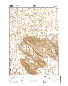
2017 Map of Horse Ridge
USGS Topo · Published 2017About this map
Horse Ridge dominates the central landscape of this Deschutes County survey, dividing the high desert terrain into distinct basins and flats. To the southwest, the boundary of the Deschutes National Forest encompasses the northern reaches of the Newberry Volcano area, where a network of off-highway vehicle trails like Ohv #10 and Ohv #25 crisscross the volcanic soils. The map documents a transition from these upland forest borders into the broad, open expanses of Stookey Flat and the Golden Basin.
Find a feature on this map
18 named features on this map. Tap any name to fly to it.
Don’t see what you’re looking for? This feature index may not catch every label — zoom into the map to look around manually.
Map Details
Editions of this 2017 Horse Ridge Map
This is the sole edition of this map. No revisions or reprints were ever made.
Other maps of this area

1926 · Bend
USGS Topo · 1:125,000

1929 · Bend
USGS Topo · 1:125,000

1931 · Newberry Crater
USGS Topo · 1:125,000

1935 · Newberry Crater
USGS Topo · 1:125,000

1955 · Crescent
USGS Topo · 1:250,000

1955 · Bend
USGS Topo · 1:250,000

1957 · Crescent
USGS Topo · 1:250,000

1957 · Bend
USGS Topo · 1:250,000

1958 · Crescent
USGS Topo · 1:250,000

1958 · Bend
USGS Topo · 1:250,000