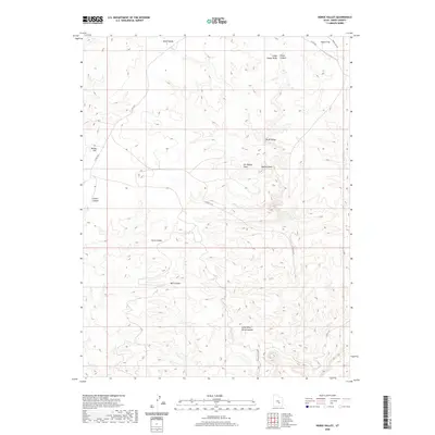
2020 Map of Horse Valley
USGS Topo · Published 2020About this map
The San Rafael Swell dominates this topographic landscape in Emery County, where deep incisions and broad flats define the drainage patterns of the desert. Remote access routes like Co RD 1012 and the Temple MT RD skirt the edges of major geological features, connecting isolated basins like McKay Flat to the higher terrain. The map captures a complex system of dry washes and slot canyons, including the narrow corridors of Little Wild Horse Canyon and Bell Canyon. The presence of Baptist Draw and Chute Canyon reveals a topography shaped by episodic water flow through the swell. These features, along with named reaches like Bruff Valley and Horse Valley, illustrate the traditional naming conventions used by cattlemen and explorers to navigate this arid interior.
Find a feature on this map
15 named features on this map. Tap any name to fly to it.
Don’t see what you’re looking for? This feature index may not catch every label — zoom into the map to look around manually.
Map Details
Editions of this 2020 Horse Valley Map
This is the sole edition of this map. No revisions or reprints were ever made.
Other maps of this area

1885 · San Rafael
USGS Topo · 1:250,000

1952 · Wild Horse
USGS Topo · 1:62,500

1952 · San Rafael Knob
USGS Topo · 1:62,500

1953 · Stinking Spring Creek 2 SE
USGS Topo · 1:24,000

1953 · Temple Mtn
USGS Topo · 1:62,500

1954 · Stinking Springs Creek 4 SW
USGS Topo · 1:24,000

1954 · Stinking Spring Creek 3 NW
USGS Topo · 1:24,000

1954 · Stinking Spring Creek 3 SE
USGS Topo · 1:24,000

1954 · Stinking Spring Creek 4 NW
USGS Topo · 1:24,000

1954 · Stinking Spring Creek 2 SW
USGS Topo · 1:24,000