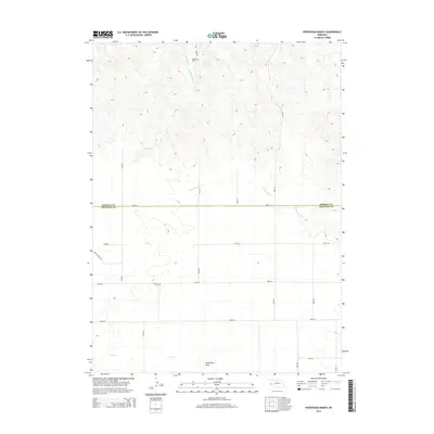
2014 Map of Horsehead Ranch
USGS Topo · Published 2014About this map
Horsehead Ranch lends its name to this high plains landscape along the county line between Morrill and Cheyenne counties. The area is defined by a grid of rural routes and the seasonal drainage patterns of the Nebraska panhandle, including the notable Wild Horse Draw in the south. Genealogists and local historians can pinpoint the location of Sanders Cem situated along Road 58, a quiet landmark in an area otherwise dominated by open range and ranching operations. The terrain is marked by intermittent watercourses like Middle Creek, Greenwood Cr, and Rush Cr, which highlight the hydraulic history of this semi-arid region. These features, along with a network of numbered section roads, illustrate the enduring land-use patterns of western Nebraska's ranching country.
Find a feature on this map
21 named features on this map. Tap any name to fly to it.
Don’t see what you’re looking for? This feature index may not catch every label — zoom into the map to look around manually.
Map Details
Editions of this 2014 Horsehead Ranch Map
This is the sole edition of this map. No revisions or reprints were ever made.
Other maps of this area

1898 · Camp Clarke
USGS Topo · 1:125,000

1954 · Scottsbluff
USGS Topo · 1:250,000

1958 · Scottsbluff
USGS Topo · 1:250,000

1965 · Courthouse Rock
USGS Topo · 1:24,000

1972 · Mud Springs SW
USGS Topo · 1:24,000

1972 · Horsehead Ranch
USGS Topo · 1:24,000

1972 · Mud Springs SE
USGS Topo · 1:24,000
1972 · Mud Springs
USGS Topo · 1:24,000

1973 · Bridgeport SW
USGS Topo · 1:24,000

1973 · Potter 2 SE
USGS Topo · 1:24,000