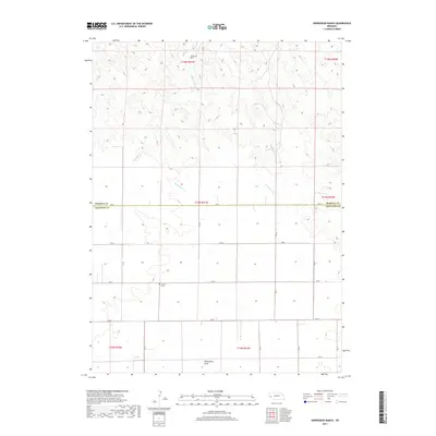
2017 Map of Horsehead Ranch
USGS Topo · Published 2017About this map
Horsehead Ranch lies in the northern reaches of this high plains landscape, situated near the seasonal waters of Middle Creek. The terrain is defined by a series of drainage patterns, including Greenwood Cr and Wild Horse Draw, which carve through the Nebraska tablelands. This 2017 survey reveals a highly organized grid of rural infrastructure, where local routes like RD 62 and RD 58 facilitate movement across the Morrill and Cheyenne county line. For those tracing local history or family lineage, the placement of Sanders Cem provides a specific point of interest in an otherwise open ranching environment. The southern portion of the sheet is marked by the presence of Rush Cr, illustrating the vital role of intermittent waterways in supporting the region's agricultural and pastoral operations.
Find a feature on this map
25 named features on this map. Tap any name to fly to it.
Don’t see what you’re looking for? This feature index may not catch every label — zoom into the map to look around manually.
Map Details
Editions of this 2017 Horsehead Ranch Map
This is the sole edition of this map. No revisions or reprints were ever made.
Other maps of this area

1898 · Camp Clarke
USGS Topo · 1:125,000

1954 · Scottsbluff
USGS Topo · 1:250,000

1958 · Scottsbluff
USGS Topo · 1:250,000

1965 · Courthouse Rock
USGS Topo · 1:24,000

1972 · Mud Springs SW
USGS Topo · 1:24,000

1972 · Horsehead Ranch
USGS Topo · 1:24,000

1972 · Mud Springs SE
USGS Topo · 1:24,000
1972 · Mud Springs
USGS Topo · 1:24,000

1973 · Bridgeport SW
USGS Topo · 1:24,000

1973 · Potter 2 SE
USGS Topo · 1:24,000