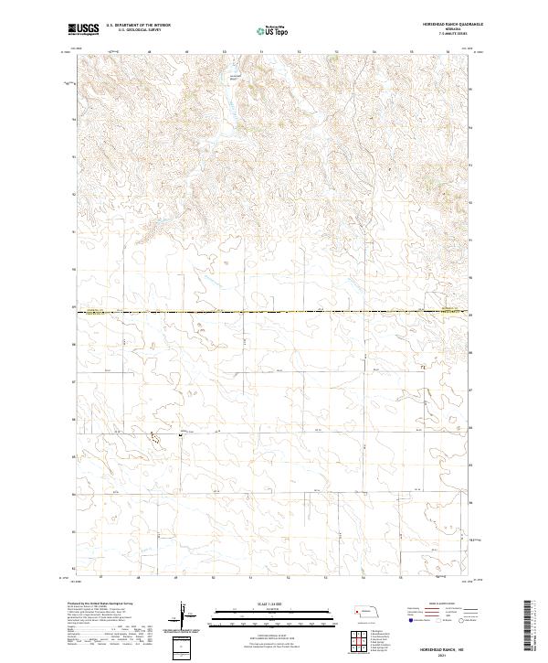
2021 Map of Horsehead Ranch
USGS Topo · Published 2021About this map
Horsehead Ranch lends its name to this section of the Nebraska panhandle, where the high plains terrain is defined by a series of intermittent watercourses. The landscape shows a classic township and range organization, with a network of rural roads including RD 62 and RD 60 cutting across the undulating topography. Middle Creek and its smaller branch Middle Cr flow through the northern reaches, while Greenwood Cr and Rush Cr drain the central and southern sections respectively.
Find a feature on this map
24 named features on this map. Tap any name to fly to it.
Don’t see what you’re looking for? This feature index may not catch every label — zoom into the map to look around manually.
Map Details
Editions of this 2021 Horsehead Ranch Map
This is the sole edition of this map. No revisions or reprints were ever made.
Other maps of this area

1898 · Camp Clarke
USGS Topo · 1:125,000

1954 · Scottsbluff
USGS Topo · 1:250,000

1958 · Scottsbluff
USGS Topo · 1:250,000

1965 · Courthouse Rock
USGS Topo · 1:24,000

1972 · Mud Springs SW
USGS Topo · 1:24,000

1972 · Horsehead Ranch
USGS Topo · 1:24,000

1972 · Mud Springs SE
USGS Topo · 1:24,000
1972 · Mud Springs
USGS Topo · 1:24,000

1973 · Bridgeport SW
USGS Topo · 1:24,000

1973 · Potter 2 SE
USGS Topo · 1:24,000