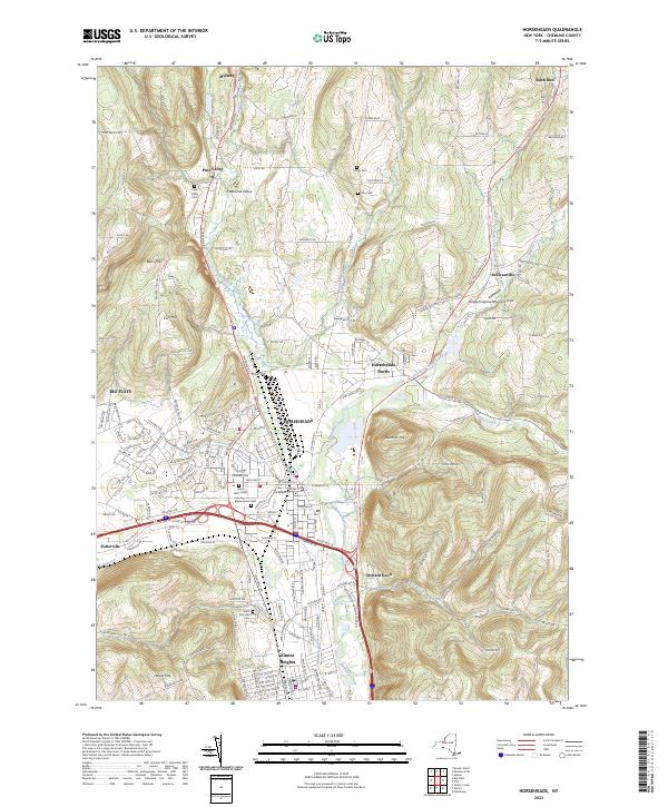
2023 Map of Horseheads
USGS Topo · Published 2023About this map
Horseheads sits as a central hub in Chemung County, where the valley floor transitions into the elevated terrain of Beers Hill and Bowman Hill. This modern survey details a landscape defined by its glacial valleys and the historical pathways that followed them, including the Conrail line and several major creeks like Newtown Creek and Catharine Creek. The map provides significant genealogical value, documenting numerous burial grounds such as Saint Marys Cem, Maple Grove Cem, and Saint Nicholas Cem near Elmira Heights. Further north, smaller settlements like Pine Valley and Sullivanville are surrounded by family-named landmarks and rural cemeteries including Turner Cem and Vary Cem. The proximity of Beaver Brook and Latta Brook illustrates the intricate drainage patterns that have shaped development from Big Flats to Fisherville.
Find a feature on this map
188 named features on this map. Tap any name to fly to it.
Don’t see what you’re looking for? This feature index may not catch every label — zoom into the map to look around manually.
Map Details
Editions of this 2023 Horseheads Map
This is the sole edition of this map. No revisions or reprints were ever made.
Other maps of this area

1893 · Ithaca
USGS Topo · 1:62,500

1895 · Ithaca
USGS Topo · 1:62,500

1895 · Elmira
USGS Topo · 1:62,500

1898 · Watkins Glen
USGS Topo · 1:62,500

1901 · Watkins
USGS Topo · 1:62,500

1902 · Waverly
USGS Topo · 1:62,500

1905 · Watkins Glen
USGS Topo · 1:125,000

1950 · Elmira
USGS Topo · 1:250,000

1950 · Alpine
USGS Topo · 1:24,000

1950 · Montour Falls
USGS Topo · 1:24,000