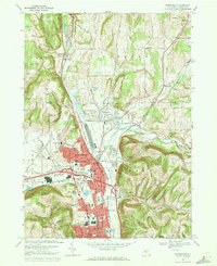
1969 Map of Horseheads
USGS Topo · Published 1971About this map
Horseheads and Elmira Heights dominate this late 1960s landscape, illustrating a period of significant suburban and industrial transition in Chemung County. The map captures a complex transportation corridor where the Penn Central and Erie-Lackawanna railroads intersect with burgeoning post-war road networks like Colonial Drive. The village centers are dense with civic life, featuring the Townhall, City Hall, and numerous neighborhood institutions such as Broad Street Sch and the Trade Sch.
Find a feature on this map
65 named features on this map. Tap any name to fly to it.
Don’t see what you’re looking for? This feature index may not catch every label — zoom into the map to look around manually.
Map Details
Editions of this 1969 Horseheads Map
This is the sole edition of this map. No revisions or reprints were ever made.
Other maps of this area

1893 · Ithaca
USGS Topo · 1:62,500

1895 · Ithaca
USGS Topo · 1:62,500

1895 · Elmira
USGS Topo · 1:62,500

1898 · Watkins Glen
USGS Topo · 1:62,500

1901 · Watkins
USGS Topo · 1:62,500

1902 · Waverly
USGS Topo · 1:62,500

1905 · Watkins Glen
USGS Topo · 1:125,000

1950 · Elmira
USGS Topo · 1:250,000

1950 · Alpine
USGS Topo · 1:24,000

1950 · Montour Falls
USGS Topo · 1:24,000