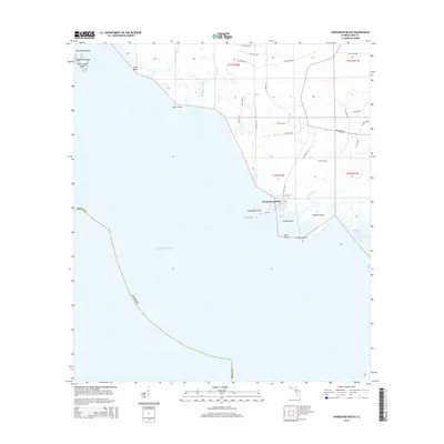
2015 Map of Horseshoe Beach
USGS Topo · Published 2015About this map
Horseshoe Beach occupies a singular position on the Dixie Co coastline, serving as a gateway to the tidal creeks and marsh islands of the Big Bend region. The settlement is centered around Main St and E 1st Ave, where land gives way to a complex network of coastal features including Horseshoe Point and the sheltered waters of Horseshoe Cove. This 2015 survey illustrates the delicate balance of this fishing community, surrounded by a labyrinth of waterways such as Tripod Creek and Boggy Cr. To the south and west, the map details numerous named landmasses like Grassy Island, Butler Island, and the Pepperfish-Keys. These islands and points, including Stuart Point and Drum Point, delineate the transition from the Florida mainland into the open Gulf of Mexico, providing critical geographic reference for local navigation and coastal history.
Find a feature on this map
45 named features on this map. Tap any name to fly to it.
Don’t see what you’re looking for? This feature index may not catch every label — zoom into the map to look around manually.
Map Details
Editions of this 2015 Horseshoe Beach Map
This is the sole edition of this map. No revisions or reprints were ever made.
Other maps of this area

1954 · Steinhatchee SW
USGS Topo · 1:24,000

1954 · Steinhatchee SE
USGS Topo · 1:24,000

1954 · Cross City SW
USGS Topo · 1:24,000

1954 · Horseshoe Beach
USGS Topo · 1:24,000

1954 · Suwannee
USGS Topo · 1:24,000

1954 · Gainesville
USGS Topo · 1:250,000

1955 · Shired Island
USGS Topo · 1:24,000

1958 · Gainesville
USGS Topo · 1:250,000

1959 · Gainesville
USGS Topo · 1:250,000

1978 · Cedar Keys
USGS Topo · 1:100,000