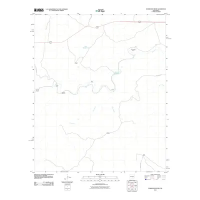
2010 Map of Horseshoe Bend
USGS Topo · Published 2010About this map
The Rio Hondo defines the character of this Chaves County landscape, winding through a complex series of turns including the prominent Horseshoe Bend in the northeast. This 2010 survey illustrates a sparsely settled ranching and farming region where water access is the primary driver of development. Named agricultural sites such as Nuñez Ranch, Border Farm, and Bar H Farm are situated near the river or its drainages, while more remote outposts like Divide Camp occupy the higher ground.
Find a feature on this map
17 named features on this map. Tap any name to fly to it.
Don’t see what you’re looking for? This feature index may not catch every label — zoom into the map to look around manually.
Map Details
Editions of this 2010 Horseshoe Bend Map
This is the sole edition of this map. No revisions or reprints were ever made.
Other maps of this area

1955 · Roswell
USGS Topo · 1:250,000

1956 · Diamond A Ranch
USGS Topo · 1:24,000

1958 · Roswell
USGS Topo · 1:250,000

1959 · Diamond A Ranch
USGS Topo · 1:24,000

1961 · Flying H
USGS Topo · 1:62,500

1961 · Indian Bluff
USGS Topo · 1:62,500

1961 · Tinnie
USGS Topo · 1:62,500

1962 · Roswell
USGS Topo · 1:250,000

1962 · Horseshoe Bend
USGS Topo · 1:62,500

1979 · Roswell
USGS Topo · 1:100,000