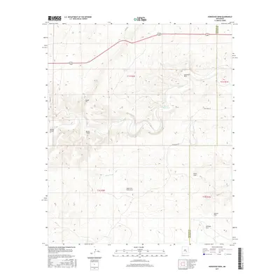
2017 Map of Horseshoe Bend
USGS Topo · Published 2017About this map
Rio Hondo carves a winding path through the Chaves County landscape, defining the central geography of this high-plains terrain. The prominent curve at Horseshoe Bend anchors the eastern side of the sheet, while the land to the west rises toward Border Hill. This 2017 survey illustrates a classic ranching environment, where water management is critical to land use, as evidenced by features like Rock House Tank and Serapio Nuñez Tank. A complex network of drainage systems, including Bonney Canyon and Border Canyon, directs seasonal runoff toward the primary river valley. High-elevation draws such as Rocky Draw and Antelope Draw stretch across the southern sections, marking the transition toward the Lincoln County border. The presence of Baton Rouge Rd and the shared corridor of Highway 70 380 provides the primary infrastructure connecting these remote drainage basins.
Find a feature on this map
19 named features on this map. Tap any name to fly to it.
Don’t see what you’re looking for? This feature index may not catch every label — zoom into the map to look around manually.
Map Details
Editions of this 2017 Horseshoe Bend Map
This is the sole edition of this map. No revisions or reprints were ever made.
Other maps of this area

1955 · Roswell
USGS Topo · 1:250,000

1956 · Diamond A Ranch
USGS Topo · 1:24,000

1958 · Roswell
USGS Topo · 1:250,000

1959 · Diamond A Ranch
USGS Topo · 1:24,000

1961 · Flying H
USGS Topo · 1:62,500

1961 · Indian Bluff
USGS Topo · 1:62,500

1961 · Tinnie
USGS Topo · 1:62,500

1962 · Roswell
USGS Topo · 1:250,000

1962 · Horseshoe Bend
USGS Topo · 1:62,500

1979 · Roswell
USGS Topo · 1:100,000