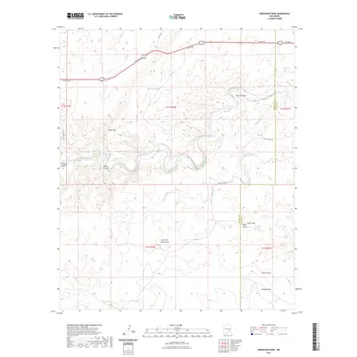
2023 Map of Horseshoe Bend
USGS Topo · Published 2023About this map
The Rio Hondo carves a winding path through this corner of the High Plains, define by its dramatic oxbow at Horseshoe Bend. This landscape is shaped by complex drainage systems and canyons, where landmarks like Border Hill and Bonney Canyon rise above the surrounding terrain. The distribution of water is a critical theme, noted by the presence of isolated man-made structures such as the Rock House Tank and Serapio Nuñez Tank, which likely supported local ranching operations in this arid environment.
Find a feature on this map
23 named features on this map. Tap any name to fly to it.
Don’t see what you’re looking for? This feature index may not catch every label — zoom into the map to look around manually.
Map Details
Editions of this 2023 Horseshoe Bend Map
This is the sole edition of this map. No revisions or reprints were ever made.
Other maps of this area

1955 · Roswell
USGS Topo · 1:250,000

1956 · Diamond A Ranch
USGS Topo · 1:24,000

1958 · Roswell
USGS Topo · 1:250,000

1959 · Diamond A Ranch
USGS Topo · 1:24,000

1961 · Flying H
USGS Topo · 1:62,500

1961 · Indian Bluff
USGS Topo · 1:62,500

1961 · Tinnie
USGS Topo · 1:62,500

1962 · Roswell
USGS Topo · 1:250,000

1962 · Horseshoe Bend
USGS Topo · 1:62,500

1979 · Roswell
USGS Topo · 1:100,000