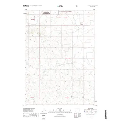
2017 Map of Horseshoe Bend
USGS Topo · Published 2017About this map
Thunder Basin National Grassland dominates the northern reaches of this Niobrara County landscape, where the Cheyenne River carves a distinctive oxbow at Horse Shoe Bend. This 2017 survey reveals a largely unpopulated terrain defined by complex drainage networks, including the paths of Coyote Cr and the branching Snyder Cr. The southern portion of the map is marked by Landis Draw, while Zerbst Rd provides a primary point of access through the central plains. This modern cartography illustrates the preservation of open range and public lands, showing the lack of traditional settlement in favor of wide-reaching conservation areas and seasonal waterways that dictate the region's ranching and recreational utility.
Find a feature on this map
15 named features on this map. Tap any name to fly to it.
Don’t see what you’re looking for? This feature index may not catch every label — zoom into the map to look around manually.
Map Details
Editions of this 2017 Horseshoe Bend Map
This is the sole edition of this map. No revisions or reprints were ever made.
Other maps of this area

1899 · Newcastle
USGS Topo · 1:125,000

1901 · Newcastle
USGS Topo · 1:125,000

1955 · Newcastle
USGS Topo · 1:250,000

1958 · Newcastle
USGS Topo · 1:250,000

1979 · Newcastle
USGS Topo · 1:100,000

1981 · Horseshoe Bend
USGS Topo · 1:24,000

1981 · Threemile Butte
USGS Topo · 1:24,000

1981 · Dixon Ranch
USGS Topo · 1:24,000
1981 · Boggy Reservoir
USGS Topo · 1:24,000

1981 · Garland Draw
USGS Topo · 1:24,000