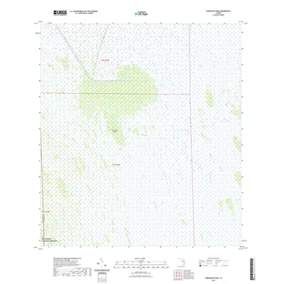
2021 Map of Horseshoe Head
USGS Topo · Published 2021About this map
The Everglades landscape dominates this 2021 survey, providing a modern view of the preserved wetlands at the intersection of southern Florida’s interior counties. The map focuses on the natural topography of the region, featuring the distinct island-like elevation of Horseshoe Head amidst the surrounding marsh. Water management infrastructure is evident through the presence of the L-28 canal, which cuts through the northern portion of the quadrangle.
Find a feature on this map
8 named features on this map. Tap any name to fly to it.
Don’t see what you’re looking for? This feature index may not catch every label — zoom into the map to look around manually.
Map Details
Editions of this 2021 Horseshoe Head Map
This is the sole edition of this map. No revisions or reprints were ever made.
Other maps of this area

1956 · Miami
USGS Topo · 1:250,000

1956 · West Palm Beach
USGS Topo · 1:250,000

1957 · West Palm Beach
USGS Topo · 1:250,000

1958 · West Palm Beach
USGS Topo · 1:250,000

1958 · Miami
USGS Topo · 1:250,000

1973 · Custard Apple Hammock
USGS Topo · 1:24,000

1973 · Everglades 4 NW
USGS Topo · 1:24,000

1973 · North Of Fiftymile Bend
USGS Topo · 1:24,000
1973 · Everglades 4 SW
USGS Topo · 1:24,000

1973 · Everglades 3 NE
USGS Topo · 1:24,000