1973 Map of North Of Fiftymile Bend
USGS Topo · Published 1976About this map
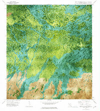
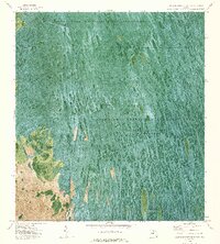
Corn Dance Trail cuts through the southern reaches of this Collier County landscape, providing a rare human-made path through a complex mosaic of cypress strands and wetland prairies. Unlike traditional topographic maps, this 1971 orthophoto base reveals the intricate vegetation patterns of the Everglades, from the dense tree clusters of Threemile Island to the isolated Hammock formations. The aerial imagery captures the natural drainage patterns and the slight elevation changes that define local ecology, while dotted land lines reflect private surveys amidst the vast, uninhabited reaches. The lack of traditional infrastructure underscores the preservation of this remote interior region during the early 1970s.
Find a feature on this map
6 named features on this map. Tap any name to fly to it.
Don’t see what you’re looking for? This feature index may not catch every label — zoom into the map to look around manually.
Map Details
Editions of this 1973 North Of Fiftymile Bend Map
2 editions found

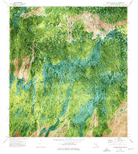
Other maps of this area

1956 · Miami
USGS Topo · 1:250,000

1956 · West Palm Beach
USGS Topo · 1:250,000

1957 · West Palm Beach
USGS Topo · 1:250,000

1958 · West Palm Beach
USGS Topo · 1:250,000

1958 · Miami
USGS Topo · 1:250,000
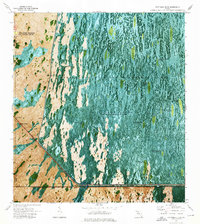
1972 · Monroe Station NE
USGS Topo · 1:24,000
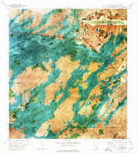
1973 · Fortymile Bend
USGS Topo · 1:24,000
1973 · Fiftymile Bend
USGS Topo · 1:24,000

1973 · Monroe Station
USGS Topo · 1:24,000
1973 · North of Fortymile Bend
USGS Topo · 1:24,000