
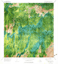
1972 Map of Monroe Station NE
USGS Topo · Published 1976About this map
Buckskin Strand and Roberts Strand define the wet, linear ecology of this Florida landscape as it appeared in the early 1970s. This orthophotomap, derived from 1971 aerial photography, provides a distinct visual record of the South Florida interior before major development pressure reached this section of Collier County. The map reveals a complex mosaic of cypress strands and wet prairies, most notably Lost Dog Prairie in the northern reaches. Human presence is minimal and practical, marked by the long straight line of Monument Road and a solitary Landing Strip. The interplay of Gum Strand against the open prairie areas shows the natural drainage patterns that characterized the region prior to extensive modern hydrological modification.
Find a feature on this map
9 named features on this map. Tap any name to fly to it.
Don’t see what you’re looking for? This feature index may not catch every label — zoom into the map to look around manually.
Map Details
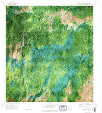
Editions of this 1972 Monroe Station NE Map
3 editions found
Other maps of this area

1956 · Miami
USGS Topo · 1:250,000

1956 · West Palm Beach
USGS Topo · 1:250,000

1957 · West Palm Beach
USGS Topo · 1:250,000

1958 · West Palm Beach
USGS Topo · 1:250,000

1958 · Miami
USGS Topo · 1:250,000

1972 · Burns Lake
USGS Topo · 1:24,000

1973 · Gator Hook Swamp
USGS Topo · 1:24,000

1973 · Fiftymile Bend
USGS Topo · 1:24,000

1973 · North Of Fiftymile Bend
USGS Topo · 1:24,000

1973 · Monroe Station
USGS Topo · 1:24,000