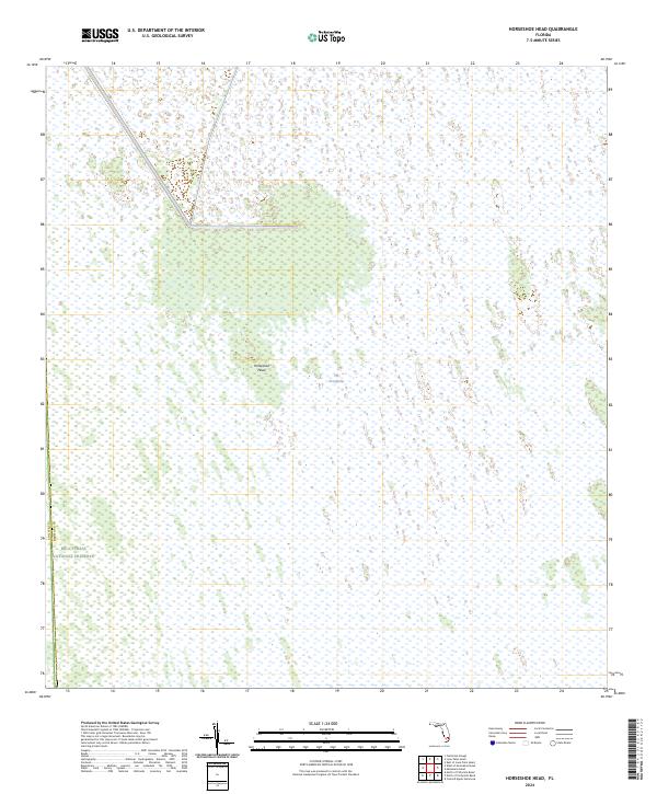
2024 Map of Horseshoe Head
USGS Topo · Published 2024About this map
The Everglades dominates this 2024 survey, presenting a landscape defined by expansive wetlands and specialized terrain. The map centers on Horseshoe Head, a distinctive feature in the interior of this watery wilderness. To the west, the boundary of the Big Cypress National Preserve is marked along the Collier and Broward County line. This modern topographic study, produced by the U.S. Geological Survey, maps the intricate hydrography of south Florida's interior, where public land survey system lines like t50s r35e and t51s r35e provide the only human-imposed grid over the natural environment. The absence of roads or settlements underscores the preserved state of this region during the early 21st century.
Find a feature on this map
7 named features on this map. Tap any name to fly to it.
Don’t see what you’re looking for? This feature index may not catch every label — zoom into the map to look around manually.
Map Details
Editions of this 2024 Horseshoe Head Map
This is the sole edition of this map. No revisions or reprints were ever made.
Other maps of this area

1956 · Miami
USGS Topo · 1:250,000

1956 · West Palm Beach
USGS Topo · 1:250,000

1957 · West Palm Beach
USGS Topo · 1:250,000

1958 · West Palm Beach
USGS Topo · 1:250,000

1958 · Miami
USGS Topo · 1:250,000

1973 · Custard Apple Hammock
USGS Topo · 1:24,000

1973 · Everglades 4 NW
USGS Topo · 1:24,000

1973 · North Of Fiftymile Bend
USGS Topo · 1:24,000
1973 · Everglades 4 SW
USGS Topo · 1:24,000

1973 · Everglades 3 NE
USGS Topo · 1:24,000