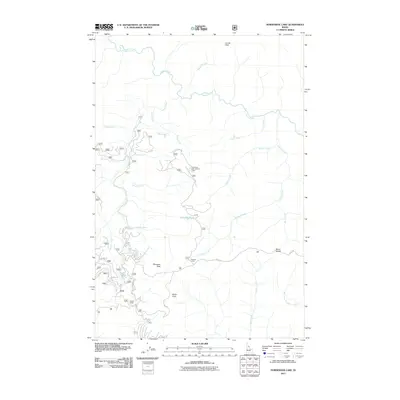
2011 Map of Horseshoe Lake
USGS Topo · Published 2011About this map
Lolo Trl follows a high ridgeline across this Idaho interior, tracing a path through the Clearwater National Forest that has served as a critical passage for centuries. The 2011 survey documents a landscape defined by sharp drainage systems and high peaks, with Cayuse Creek and its many tributaries, including Gravey Creek and Grass Creek, carving deep into the terrain. Remote outposts such as Howard Camp and Saddle Camp provide temporary footholds in this wilderness, while the Horseshoe Lake Lookout Tower overlooks its namesake, Horseshoe Lake. The topography is punctuated by distinctive formations like Devils Chair and Moccasin Peak, illustrating the complex network of forest roads and trails required to navigate these elevations. Geologic and cartographic interest is found in the varied watercourses, from West Fork Postoffice Creek to the headwaters of Horseshoe Creek.
Find a feature on this map
28 named features on this map. Tap any name to fly to it.
Don’t see what you’re looking for? This feature index may not catch every label — zoom into the map to look around manually.
Map Details
Editions of this 2011 Horseshoe Lake Map
This is the sole edition of this map. No revisions or reprints were ever made.
Other maps of this area

1911 · Lolo
USGS Topo · 1:250,000

1913 · Lolo
USGS Topo · 1:250,000

1956 · Hamilton
USGS Topo · 1:250,000

1959 · Hamilton
USGS Topo · 1:250,000

1960 · Hamilton
USGS Topo · 1:250,000

1964 · Hamilton
USGS Topo · 1:250,000

1965 · Scurvy Mtn.
USGS Topo · 1:24,000

1965 · Gorman Hill
USGS Topo · 1:24,000

1965 · Lookout Peak
USGS Topo · 1:24,000

1965 · Horseshoe Lake
USGS Topo · 1:24,000