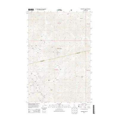
2013 Map of Horseshoe Lake
USGS Topo · Published 2013About this map
Clearwater National Forest dominates this interior portion of Idaho County and Clearwater County, where the terrain is defined by high ridgelines and the headwaters of numerous mountain streams. The historical Lolo Trl winds through the southern portion of the quadrangle, passing near established backcountry sites like Saddle Camp and Howard Camp. This area is characterized by steep elevation changes, ranging from the summit of Lunde Peak and the unique formation of Devils Chair to the secluded basin of Horseshoe Lake. The presence of the Horseshoe Lake Lookout Tower on a prominent ridge reflects the area's significance for forest fire surveillance, while landmarks like Moccasin Peak and Moon Saddle serve as critical navigational points for travelers navigating the complex drainage systems of Cayuse Creek and Howard Cr.
Find a feature on this map
32 named features on this map. Tap any name to fly to it.
Don’t see what you’re looking for? This feature index may not catch every label — zoom into the map to look around manually.
Map Details
Editions of this 2013 Horseshoe Lake Map
This is the sole edition of this map. No revisions or reprints were ever made.
Other maps of this area

1911 · Lolo
USGS Topo · 1:250,000

1913 · Lolo
USGS Topo · 1:250,000

1956 · Hamilton
USGS Topo · 1:250,000

1959 · Hamilton
USGS Topo · 1:250,000

1960 · Hamilton
USGS Topo · 1:250,000

1964 · Hamilton
USGS Topo · 1:250,000

1965 · Scurvy Mtn.
USGS Topo · 1:24,000

1965 · Gorman Hill
USGS Topo · 1:24,000

1965 · Lookout Peak
USGS Topo · 1:24,000

1965 · Horseshoe Lake
USGS Topo · 1:24,000