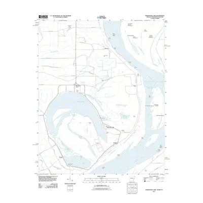
2011 Map of Horseshoe Lake
USGS Topo · Published 2011About this map
Horseshoe Lake dominates this landscape along the Arkansas-Tennessee border, its distinct oxbow shape marking the former path of the Mississippi River. The surrounding alluvial plain is defined by a dense network of agricultural holdings and riverside lodges, including Cunningham Farm, Rodgers Farm, and Rock Point Lodge. These labels reflect a rural economy tied closely to the fertile soils and recreational access of the river bottoms. Small community clusters such as Pinckney, Seyppel, and Bruins serve as local hubs, while Thompson Grove sits near the northern shore of the lake.
Find a feature on this map
75 named features on this map. Tap any name to fly to it.
Don’t see what you’re looking for? This feature index may not catch every label — zoom into the map to look around manually.
Map Details
Editions of this 2011 Horseshoe Lake Map
This is the sole edition of this map. No revisions or reprints were ever made.
Other maps of this area

1908 · Lake Cormorant
USGS Topo · 1:24,000

1912 · Lake Cormorant
USGS Topo · 1:31,680

1916 · Memphis
USGS Topo · 1:62,500

1925 · Memphis
USGS Topo · 1:48,000

1927 · Memphis
USGS Topo · 1:62,500

1931 · Horseshoe Lake
USGS Topo · 1:62,500

1932 · Horn Lake
USGS Topo · 1:48,000

1935 · Horn Lake
USGS Topo · 1:62,500

1939 · Horseshoe Lake
USGS Topo · 1:62,500

1939 · Edmondson
USGS Topo · 1:62,500