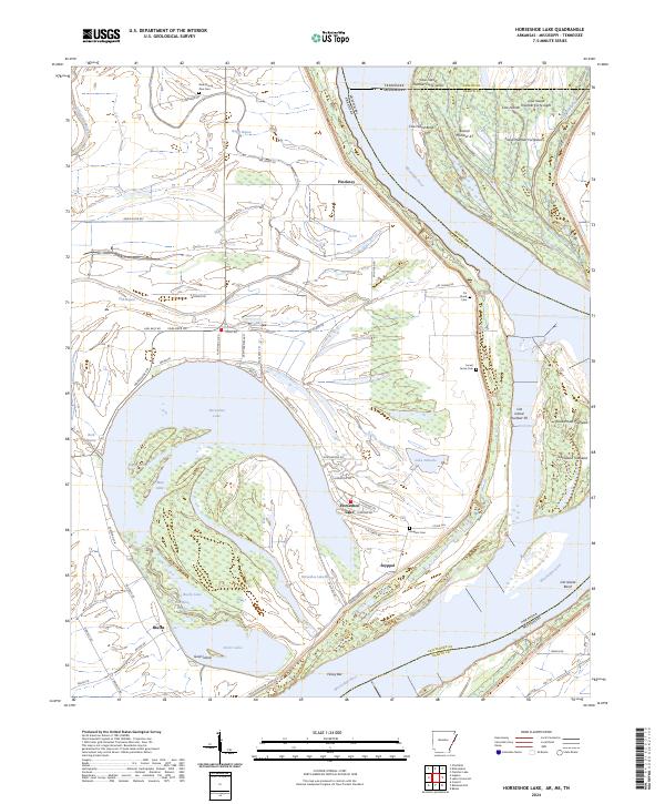
2024 Map of Horseshoe Lake
USGS Topo · Published 2024About this map
Horseshoe Lake dominates the landscape of eastern Crittenden County, where the dramatic oxbow remains a central feature of the delta terrain. This modern survey illustrates the complex boundary lines where Arkansas, Tennessee, and Mississippi converge along the shifting course of the Mississippi River. Small communities such as Pinckney and Bruins sit near the river's edge, protected by the massive Mississippi River Levee system that snakes across the southern portion of the sheet. For those researching local roots, the map identifies several rural burial grounds, including New Mount Zion Cem in the north and Locust Grove Cem further south. The topography is defined by the hydrologic history of the river, with numerous named backwaters like Mud Lake, Porter Lake, and Lake Deloche scattered between the ridges. Large river islands such as Cat Island and Cow Island Number Forty-seven illustrate the ongoing evolution of the channel banks and towheads.
Find a feature on this map
74 named features on this map. Tap any name to fly to it.
Don’t see what you’re looking for? This feature index may not catch every label — zoom into the map to look around manually.
Map Details
Editions of this 2024 Horseshoe Lake Map
This is the sole edition of this map. No revisions or reprints were ever made.
Other maps of this area

1908 · Lake Cormorant
USGS Topo · 1:24,000

1912 · Lake Cormorant
USGS Topo · 1:31,680

1916 · Memphis
USGS Topo · 1:62,500

1925 · Memphis
USGS Topo · 1:48,000

1927 · Memphis
USGS Topo · 1:62,500

1931 · Horseshoe Lake
USGS Topo · 1:62,500

1932 · Horn Lake
USGS Topo · 1:48,000

1935 · Horn Lake
USGS Topo · 1:62,500

1939 · Horseshoe Lake
USGS Topo · 1:62,500

1939 · Edmondson
USGS Topo · 1:62,500