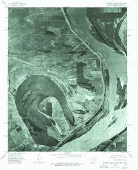
1975 Map of Horseshoe Lake NE
USGS Topo · Published 1976About this map
Horseshoe Lake dominates this Arkansas riverfront landscape, showcasing a massive oxbow formation that traces a former path of the Mississippi River. This mid-1970s orthophotoquad provides an unfiltered photographic look at the alluvial plain’s complex drainage and land-use patterns. Small settlements like Pinckney, Thompson Grove, and Seyppel are visible within the fertile bottomlands, often defined by their proximity to the sweeping river bends and interior water bodies like Porter Lake. The imagery reveals the intricate network of agricultural fields and narrow woodlots that characterize the Crittenden County delta during this era. Because this is an orthophotograph, it preserves the exact placement of tree lines, farm roads, and shorelines as they existed in 1975, offering researchers a literal snapshot of the terrain prior to modern development.
Find a feature on this map
6 named features on this map. Tap any name to fly to it.
Don’t see what you’re looking for? This feature index may not catch every label — zoom into the map to look around manually.
Map Details
Editions of this 1975 Horseshoe Lake NE Map
This is the sole edition of this map. No revisions or reprints were ever made.
Other maps of this area

1908 · Lake Cormorant
USGS Topo · 1:24,000

1912 · Lake Cormorant
USGS Topo · 1:31,680

1916 · Memphis
USGS Topo · 1:62,500

1925 · Memphis
USGS Topo · 1:48,000

1927 · Memphis
USGS Topo · 1:62,500

1931 · Horseshoe Lake
USGS Topo · 1:62,500

1932 · Horn Lake
USGS Topo · 1:48,000

1935 · Horn Lake
USGS Topo · 1:62,500

1939 · Horseshoe Lake
USGS Topo · 1:62,500

1939 · Edmondson
USGS Topo · 1:62,500