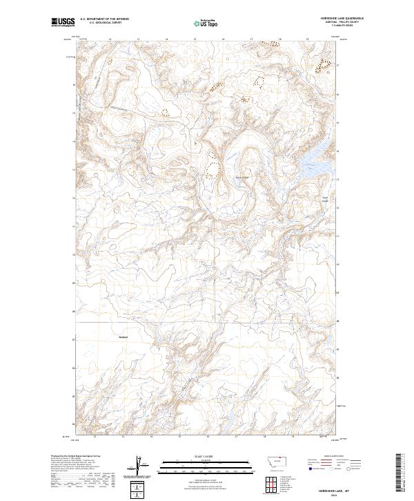
2024 Map of Horseshoe Lake
USGS Topo · Published 2024About this map
Sumner anchors the western edge of this landscape in Phillips County, where the high plains are deeply incised by a series of drainage features known locally as coulees. The terrain is defined by the winding paths of Woody Island Coulee, Cowie Coulee, and Gloyn Coulee, which create a complex network of ridges and draws characteristic of the Montana badlands. In the northeast, the eponymous Horseshoe Lake provides a rare permanent water feature in an otherwise arid environment. This USGS survey highlights the sparse but critical transportation network of the modern era, showing how routes like Sunnyslope Rd and Turner Cutacross Rd navigate the township and range boundaries of t36n r28e and t35n r28e. The map illustrates a ranching landscape where development is concentrated along these few reliable roads while the rest of the land remains shaped by the natural erosion of Alkali Coulee.
Find a feature on this map
10 named features on this map. Tap any name to fly to it.
Don’t see what you’re looking for? This feature index may not catch every label — zoom into the map to look around manually.
Map Details
Editions of this 2024 Horseshoe Lake Map
This is the sole edition of this map. No revisions or reprints were ever made.
Other maps of this area

1920 · Avery
USGS Topo · 1:125,000

1920 · Cowan
USGS Topo · 1:125,000

1953 · Havre
USGS Topo · 1:250,000

1954 · Glasgow
USGS Topo · 1:250,000

1957 · Glasgow
USGS Topo · 1:250,000

1957 · Havre
USGS Topo · 1:250,000

1958 · Glasgow
USGS Topo · 1:250,000

1958 · Havre
USGS Topo · 1:250,000

1984 · Chapman
USGS Topo · 1:24,000

1984 · Emerick Bench
USGS Topo · 1:24,000