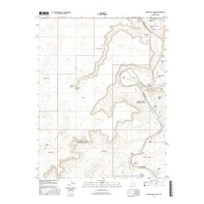
2017 Map of Horsethief Canyon
USGS Topo · Published 2017About this map
The Green River carves a massive, serpentine path through the heart of this desert landscape, creating a series of distinctive river bottoms and high-walled canyons at the boundary of Canyonlands National Park and Glen Canyon National Recreation Area. These flat lands along the river, including Upheaval Bottom, Hardscrabble Bottom, and Potato Bottom, provided rare accessible areas for exploration and travel beneath the towering Bighorn Mesa and Horsethief Point.
Find a feature on this map
37 named features on this map. Tap any name to fly to it.
Don’t see what you’re looking for? This feature index may not catch every label — zoom into the map to look around manually.
Map Details
Editions of this 2017 Horsethief Canyon Map
This is the sole edition of this map. No revisions or reprints were ever made.
Other maps of this area

1885 · San Rafael
USGS Topo · 1:250,000

1885 · La Sal
USGS Topo · 1:250,000

1951 · The Knoll
USGS Topo · 1:62,500

1951 · Upheaval Dome
USGS Topo · 1:62,500

1952 · Tidwell 4 SE
USGS Topo · 1:24,000

1952 · Carlisle 2 NW
USGS Topo · 1:24,000

1952 · Carlisle 2 SW
USGS Topo · 1:24,000

1952 · Moab 3 SW
USGS Topo · 1:24,000

1953 · Orange Cliffs 1 SE
USGS Topo · 1:24,000

1953 · Orange Cliffs 1 NE
USGS Topo · 1:24,000