
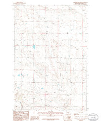
1979 Map of Horsethief Creek
USGS Topo · Published 1980About this map
Horsethief Creek meanders through the central section of this Musselshell County landscape, which by the late 1970s was defined by a mix of ranching water sources and energy infrastructure. The terrain is marked by numerous wells and several drill holes, indicating active resource exploration or development during this period. In the southeastern corner, the CM ST P & P railroad line cuts across the terrain near Naderman, while the surrounding area is drained by Alkali Creek to the north and Currant Creek to the south.
Find a feature on this map
15 named features on this map. Tap any name to fly to it.
Don’t see what you’re looking for? This feature index may not catch every label — zoom into the map to look around manually.
Map Details
Editions of this 1979 Horsethief Creek Map
This is the sole edition of this map. No revisions or reprints were ever made.
Other maps of this area

1954 · Roundup
USGS Topo · 1:250,000

1958 · Roundup
USGS Topo · 1:250,000

1979 · Roundup
USGS Topo · 1:100,000

1979 · Bundy
USGS Topo · 1:24,000

1979 · Timber Buttes South
USGS Topo · 1:24,000

1979 · Harper Coulee
USGS Topo · 1:24,000

1979 · Elso
USGS Topo · 1:24,000

1979 · Roundup
USGS Topo · 1:24,000

1986 · Lake Mason SE
USGS Topo · 1:24,000
1986 · Timber Buttes North
USGS Topo · 1:24,000