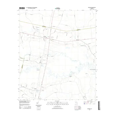
2014 Map of Hortense
USGS Topo · Published 2014About this map
The low-lying wetlands of Brantley County are defined by the winding course of the Satilla River and its tributary, the Little Satilla River. This landscape is marked by a series of distinct river features such as Stricklands Reach and Buzzard Roost Reach, alongside bluffs like Strickland Bluff and Baxter Bluff. The settlement pattern follows the higher ground between these waterways, anchored by the community of Hortense at the intersection of Ga-32 and Us-301. Genealogical interest is found in the local burials at Satilla Cem, Baxter Cem, and Lewis Cem, which serve as quiet markers of the families who settled this timber and river country. Small unincorporated locales like Trudie, Raybon, and Needmore dot the secondary roads, while the Humpback Bridge spans the waters near the Pierce County line.
Find a feature on this map
85 named features on this map. Tap any name to fly to it.
Don’t see what you’re looking for? This feature index may not catch every label — zoom into the map to look around manually.
Map Details
Editions of this 2014 Hortense Map
This is the sole edition of this map. No revisions or reprints were ever made.
Other maps of this area

1917 · Nahunta
USGS Topo · 1:62,500

1918 · Hortense
USGS Topo · 1:62,500

1918 · Nahunta
USGS Topo · 1:62,500

1944 · Hortense
USGS Topo · 1:62,500

1946 · Brunswick
USGS Topo · 1:250,000

1948 · Brunswick
USGS Topo · 1:250,000

1953 · Waycross
USGS Topo · 1:250,000

1956 · Brunswick
USGS Topo · 1:250,000

1958 · Waycross
USGS Topo · 1:250,000

1961 · Brunswick
USGS Topo · 1:250,000