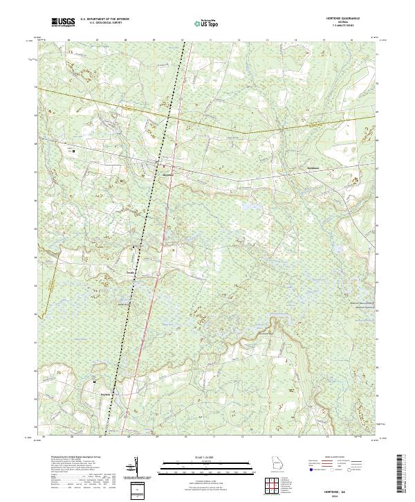
2024 Map of Hortense
USGS Topo · Published 2024About this map
The Little Satilla River and the larger Satilla River dominate the central landscape of this Southeast Georgia region, forming a complex network of wetlands and reaches. Settlement is concentrated along the CSX Transportation railroad corridor, where the communities of Hortense and Trudie are established near the riverbanks. For genealogists and local historians, the presence of family-named landmarks like Baxter Cem, Satilla Cem, and Lewis Cem provides essential grounding for tracing residents of Brantley, Wayne, and Pierce counties. The river geography is notably detailed, featuring specific landings and points such as Strickland Bluff, Five Points Reach, and Robinson Hammock. This modern survey illustrates how traditional river-and-rail geography continues to define the rural character of the area, even as modern roads like Old Highway Rd connect these long-standing communities.
Find a feature on this map
90 named features on this map. Tap any name to fly to it.
Don’t see what you’re looking for? This feature index may not catch every label — zoom into the map to look around manually.
Map Details
Editions of this 2024 Hortense Map
This is the sole edition of this map. No revisions or reprints were ever made.
Other maps of this area

1917 · Nahunta
USGS Topo · 1:62,500

1918 · Hortense
USGS Topo · 1:62,500

1918 · Nahunta
USGS Topo · 1:62,500

1944 · Hortense
USGS Topo · 1:62,500

1946 · Brunswick
USGS Topo · 1:250,000

1948 · Brunswick
USGS Topo · 1:250,000

1953 · Waycross
USGS Topo · 1:250,000

1956 · Brunswick
USGS Topo · 1:250,000

1958 · Waycross
USGS Topo · 1:250,000

1961 · Brunswick
USGS Topo · 1:250,000