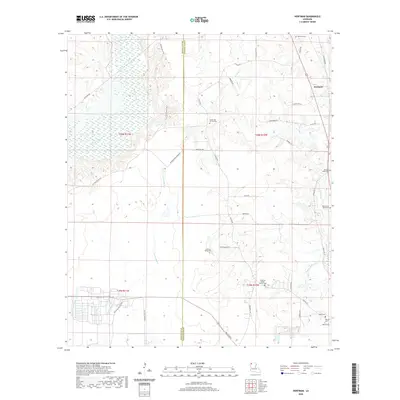
2020 Map of Hortman
USGS Topo · Published 2020About this map
Bossier and Webster Parishes meet along a landscape defined by meandering waterways and numerous small burial grounds. The settlement of Hortman is situated in the northeastern quadrant, while the surrounding area is woven together by a network of rural roads such as Cottonwood Rd and Bellevue Rd. The terrain is dominated by the intricate hydrology of Bodcau Creek and Clarke Bayou, which create a complex drainage system across the low-lying bottomlands. Genealogists and local historians will find significant value in the high density of family and church burial sites, including Growing Valley Church Cem, Bright Star Church Cem, and the more isolated Baten Cem. The presence of Bellevue Oilfield Rd suggests the local importance of the petroleum industry, while names like International Paper Rd point toward the role of timber and paper production in the region's 21st-century economy.
Find a feature on this map
45 named features on this map. Tap any name to fly to it.
Don’t see what you’re looking for? This feature index may not catch every label — zoom into the map to look around manually.
Map Details
Editions of this 2020 Hortman Map
This is the sole edition of this map. No revisions or reprints were ever made.
Other maps of this area

1922 · Sarepta
USGS Topo · 1:62,500

1924 · Sarepta
USGS Topo · 1:62,500

1932 · Bossier SE
USGS Topo · 1:31,680

1932 · Bossier NE
USGS Topo · 1:31,680

1947 · Minden
USGS Topo · 1:62,500

1948 · Bossier City
USGS Topo · 1:62,500

1949 · Minden
USGS Topo · 1:62,500

1950 · Plain Dealing SE
USGS Topo · 1:31,680

1955 · Shreveport
USGS Topo · 1:250,000
1955 · Bossier City
USGS Topo · 1:62,500