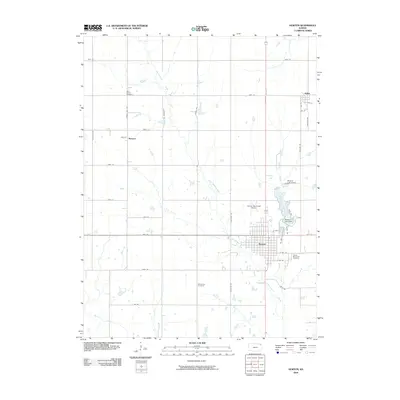
2009 Map of Horton
USGS Topo · Published 2009About this map
The city of Horton serves as the primary hub of this Brown County landscape, characterized by a grid of agricultural section roads and the winding paths of Grasshopper Creek and the Little Delaware River. In the northeastern corner, the small settlement of Willis sits near the headwaters of local tributaries, while the community of Mercier is positioned to the west. A significant local landmark is Mission Lake, held by the Mission Lake Dam and surrounded by community resources like the Mission Lake Camp. For genealogists, the map identifies several distinct burial sites including Saint Peters Cemetery, Wheatland Cemetery, and the Horton Municipal Cemetery. The terrain is defined by its transition from high prairie farmland to the wooded riparian zones of Otter Creek and Walnut Creek, with the Horton Municipal Airport situated just north of the city limits.
Find a feature on this map
44 named features on this map. Tap any name to fly to it.
Don’t see what you’re looking for? This feature index may not catch every label — zoom into the map to look around manually.
Map Details
Editions of this 2009 Horton Map
This is the sole edition of this map. No revisions or reprints were ever made.
Other maps of this area

1885 · Atchison
USGS Topo · 1:125,000

1888 · Atchison
USGS Topo · 1:125,000

1888 · Hiawatha
USGS Topo · 1:125,000

1893 · Atchison
USGS Topo · 1:125,000

1894 · Hiawatha
USGS Topo · 1:125,000

1950 · Kansas City
USGS Topo · 1:250,000

1954 · Kansas City
USGS Topo · 1:250,000

1956 · Kansas City
USGS Topo · 1:250,000

1960 · Kansas City
USGS Topo · 1:250,000

1960 · Fairview
USGS Topo · 1:24,000