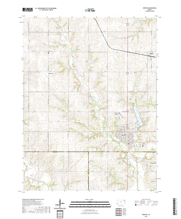
2022 Map of Horton
USGS Topo · Published 2022About this map
Horton serves as the primary hub in this Kansas landscape, where the borders of Brown, Jackson, and Atchison counties meet. The settlement pattern follows a distinct grid of section-line roads, such as Jackrabbit Rd and Meadowlark Rd, while the Little Delaware River and Mission Cr carve a more fluid path through the terrain. Several smaller communities including Willis, Mercier, and Kennekuk are situated at intervals along these routes, often near water sources or key intersections.
Find a feature on this map
70 named features on this map. Tap any name to fly to it.
Don’t see what you’re looking for? This feature index may not catch every label — zoom into the map to look around manually.
Map Details
Editions of this 2022 Horton Map
This is the sole edition of this map. No revisions or reprints were ever made.
Other maps of this area

1885 · Atchison
USGS Topo · 1:125,000

1888 · Atchison
USGS Topo · 1:125,000

1888 · Hiawatha
USGS Topo · 1:125,000

1893 · Atchison
USGS Topo · 1:125,000

1894 · Hiawatha
USGS Topo · 1:125,000

1950 · Kansas City
USGS Topo · 1:250,000

1954 · Kansas City
USGS Topo · 1:250,000

1956 · Kansas City
USGS Topo · 1:250,000

1960 · Kansas City
USGS Topo · 1:250,000

1960 · Fairview
USGS Topo · 1:24,000