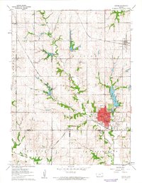
1961 Map of Horton
USGS Topo · Published 1962About this map
The Horton townsite serves as the primary hub of this early 1960s landscape, situated at the junction of the Chicago Rock Island And Pacific and Missouri Pacific railroads. The town’s social and civic infrastructure is well-defined, featuring a High Sch, City Hall, and Hospital near the central grid. To the northeast, the Mission Lake recreation area highlights the transition from agricultural land to community leisure space, anchored by the Lakeview Country Club and Mission Lake Camp.
Find a feature on this map
29 named features on this map. Tap any name to fly to it.
Don’t see what you’re looking for? This feature index may not catch every label — zoom into the map to look around manually.
Map Details
Editions of this 1961 Horton Map
This is the sole edition of this map. No revisions or reprints were ever made.
Other maps of this area

1885 · Atchison
USGS Topo · 1:125,000

1888 · Atchison
USGS Topo · 1:125,000

1888 · Hiawatha
USGS Topo · 1:125,000

1893 · Atchison
USGS Topo · 1:125,000

1894 · Hiawatha
USGS Topo · 1:125,000

1950 · Kansas City
USGS Topo · 1:250,000

1954 · Kansas City
USGS Topo · 1:250,000

1956 · Kansas City
USGS Topo · 1:250,000

1960 · Kansas City
USGS Topo · 1:250,000

1960 · Fairview
USGS Topo · 1:24,000