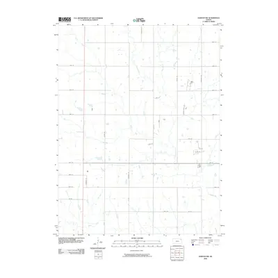
2009 Map of Horton NW
USGS Topo · Published 2009About this map
The Delaware River meanders through this portion of Brown County, forming the central drainage for a landscape defined by its rural grid and creek systems. To the west, Plum Creek flows south toward the basin, while Craig Creek and Squaw Creek carve paths through the northern and eastern sections. This survey captures the region as it appeared in the early 21st century, showing a transition toward more descriptive local road names alongside the traditional section-line numbering. The map reveals a highly structured agricultural network where local thoroughfares like Dogwood Rd, Golden-Eagle Rd, and Chipmunk Rd intersect with established routes like 110th St. In the southern portion, Mud Creek crosses through the township boundaries, illustrating the enduring relationship between the area's natural hydrology and its long-standing farming infrastructure.
Find a feature on this map
33 named features on this map. Tap any name to fly to it.
Don’t see what you’re looking for? This feature index may not catch every label — zoom into the map to look around manually.
Map Details
Editions of this 2009 Horton NW Map
This is the sole edition of this map. No revisions or reprints were ever made.
Other maps of this area

1888 · Hiawatha
USGS Topo · 1:125,000

1894 · Hiawatha
USGS Topo · 1:125,000

1950 · Kansas City
USGS Topo · 1:250,000

1954 · Kansas City
USGS Topo · 1:250,000

1956 · Kansas City
USGS Topo · 1:250,000

1960 · Kansas City
USGS Topo · 1:250,000

1960 · Fairview
USGS Topo · 1:24,000
1960 · Horton NW
USGS Topo · 1:24,000
1961 · Hiawatha
USGS Topo · 1:24,000
1961 · Netawaka
USGS Topo · 1:24,000