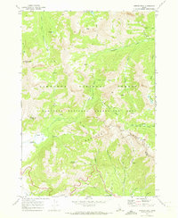
1970 Map of Horton Peak
USGS Topo · Published 1973About this map
Horton Peak Lookout stands as a primary vantage point over this high-altitude landscape within the Sawtooth National Forest and the Sawtooth National Recreation Area. The terrain is defined by the sharp rise of the Boulder Mountains and high basins containing Champion Lakes and Rainbow Lake. Evidence of high-country land use is visible through several corrals and a designated Camp along the Pole Creek corridor, which also houses the Pole Creek Guard Station.
Find a feature on this map
34 named features on this map. Tap any name to fly to it.
Don’t see what you’re looking for? This feature index may not catch every label — zoom into the map to look around manually.
Map Details
Editions of this 1970 Horton Peak Map
3 editions found
Other maps of this area

1900 · Sawtooth
USGS Topo · 1:125,000

1919 · Custer
USGS Topo · 1:125,000

1922 · Custer
USGS Topo · 1:125,000

1955 · Hailey
USGS Topo · 1:250,000

1957 · Challis
USGS Topo · 1:250,000

1959 · Hailey
USGS Topo · 1:250,000

1960 · Challis
USGS Topo · 1:250,000

1962 · Hailey
USGS Topo · 1:250,000

1963 · Challis
USGS Topo · 1:250,000

1963 · Alturas Lake
USGS Topo · 1:24,000