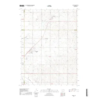
2017 Map of Hoskins
USGS Topo · Published 2017About this map
Hoskins sits at the intersection of four Nebraska counties—Pierce, Wayne, Madison, and Stanton—serving as a focal point in a landscape shaped by grid-line roads and rolling drainage basins. The area exhibits a transition from traditional rural homesteads to the residential expansion seen at Woodland Park further south. This 2017 survey documents the persistent cultural landmarks of the region, including Trinity Cem and Lutheran Cem, alongside private aviation facilities like Falk Air Field and Kohles Airport. The hydrologic pattern is defined by north-south flowing tributaries such as Spring Br, Pleasant Run, and Maskenthine Cr, which carve through the agricultural uplands. The road network, including 841st RD and 560th Ave, maintains the strict section-line layout characteristic of the Great Plains, illustrating how modern transportation and land use remain tethered to the original Public Land Survey System.
Find a feature on this map
57 named features on this map. Tap any name to fly to it.
Don’t see what you’re looking for? This feature index may not catch every label — zoom into the map to look around manually.
Map Details
Editions of this 2017 Hoskins Map
This is the sole edition of this map. No revisions or reprints were ever made.
Other maps of this area

1955 · Sioux City
USGS Topo · 1:250,000

1955 · Fremont
USGS Topo · 1:250,000

1957 · Fremont
USGS Topo · 1:250,000

1958 · Sioux City
USGS Topo · 1:250,000

1958 · Fremont
USGS Topo · 1:250,000

1959 · Sioux City
USGS Topo · 1:250,000

1963 · Hoskins
USGS Topo · 1:24,000

1963 · Wayne SW
USGS Topo · 1:24,000

1963 · Norfolk
USGS Topo · 1:24,000

1963 · Winside
USGS Topo · 1:24,000