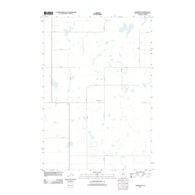
2012 Map of Hosmer NE
USGS Topo · Published 2012About this map
Glacial potholes and small prairie wetlands dot this portion of McPherson County, creating a fragmented water-rich landscape characteristic of the Missouri Coteau. The land is organized by a precise section-line road network, including 114th St and 347th Ave, which service the remote agricultural plots of the region. This 2012 survey highlights the cultural imprint of early German-Russian and European settlers through its recorded burial grounds. The Lutheran Cem and Congregational Cem sit as quiet landmarks in an area otherwise defined by expansive fields and intermittent seasonal ponds, showing the persistence of local community identity in rural South Dakota.
Find a feature on this map
15 named features on this map. Tap any name to fly to it.
Don’t see what you’re looking for? This feature index may not catch every label — zoom into the map to look around manually.
Map Details
Editions of this 2012 Hosmer NE Map
This is the sole edition of this map. No revisions or reprints were ever made.
Other maps of this area

1954 · Aberdeen
USGS Topo · 1:250,000

1956 · Aberdeen
USGS Topo · 1:250,000

1968 · Long Lake
USGS Topo · 1:24,000

1978 · Hosmer NW
USGS Topo · 1:24,000

1978 · Hosmer NE
USGS Topo · 1:24,000

1978 · Hosmer SE
USGS Topo · 1:24,000

1978 · Hosmer
USGS Topo · 1:24,000

1978 · Schumacher Lake
USGS Topo · 1:24,000

1978 · Schumacher Lake SW
USGS Topo · 1:24,000

1978 · Plainview Colony NW
USGS Topo · 1:24,000