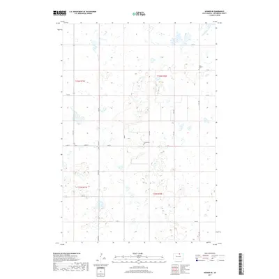
2017 Map of Hosmer NE
USGS Topo · Published 2017About this map
McPherson County high plains terrain is defined by its glacial potholes and small wetlands across this region of South Dakota. The landscape reflects the systematic grid of the Public Land Survey System, with section lines and gravel roads like 114th St and 115th St providing the primary structure for the area's rural transit. Local history is anchored by early religious settlements, evidenced by the presence of Salem Lutheran Cem and Congregational Cem. These sites serve as physical markers of the homesteading families who established farming communities across the Dakota prairies in the late 19th and early 20th centuries. The map details the drainage patterns and numerous small basins that characterize this section of the James River valley upland.
Find a feature on this map
2 named features on this map. Tap any name to fly to it.
Don’t see what you’re looking for? This feature index may not catch every label — zoom into the map to look around manually.
Map Details
Editions of this 2017 Hosmer NE Map
This is the sole edition of this map. No revisions or reprints were ever made.
Other maps of this area

1954 · Aberdeen
USGS Topo · 1:250,000

1956 · Aberdeen
USGS Topo · 1:250,000

1968 · Long Lake
USGS Topo · 1:24,000

1978 · Hosmer NW
USGS Topo · 1:24,000

1978 · Hosmer NE
USGS Topo · 1:24,000

1978 · Hosmer SE
USGS Topo · 1:24,000

1978 · Hosmer
USGS Topo · 1:24,000

1978 · Schumacher Lake
USGS Topo · 1:24,000

1978 · Schumacher Lake SW
USGS Topo · 1:24,000

1978 · Plainview Colony NW
USGS Topo · 1:24,000