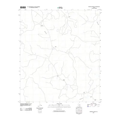
2010 Map of Hospital Ranch
USGS Topo · Published 2010About this map
Hospital Ranch sits at the center of this Crockett County landscape, a region defined by scattered ranching estates and an intricate network of seasonal drainage channels. The map documents a classic West Texas pastoral pattern, where life and economy are oriented around these named draws. To the north, Glasscock Ranch and Red Mill Ranch anchor the high ground, while the southern reaches are marked by Puckett Ranch and Kaiser Ranch. These homesteads are connected by a web of light-duty and unimproved roads that navigate the local topography. Significant natural features include Willow Draw, which winds through the central corridor, and Granger Draw, defining the eastern edge of the survey. The presence of named landmarks like Berger Ranch alongside ephemeral watercourses like Chalk Draw highlights the enduring importance of established property lines and reliable drainage in this arid environment.
Find a feature on this map
12 named features on this map. Tap any name to fly to it.
Don’t see what you’re looking for? This feature index may not catch every label — zoom into the map to look around manually.
Map Details
Editions of this 2010 Hospital Ranch Map
This is the sole edition of this map. No revisions or reprints were ever made.
Other maps of this area

1954 · Sonora
USGS Topo · 1:250,000

1958 · Sonora
USGS Topo · 1:250,000

1967 · Nolen Draw
USGS Topo · 1:24,000

1967 · Savell Ranch
USGS Topo · 1:24,000

1967 · Ozona SE
USGS Topo · 1:24,000

1967 · Shafter Draw
USGS Topo · 1:24,000

1967 · Crockett Heights
USGS Topo · 1:24,000

1967 · Hudspeth Draw
USGS Topo · 1:24,000

1967 · Caverns Of Sonora
USGS Topo · 1:24,000
1967 · Hospital Ranch
USGS Topo · 1:24,000