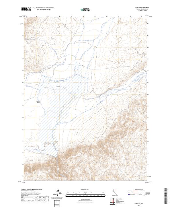
2023 Map of Hot Lake
USGS Topo · Published 2023About this map
Hot Lake and its surrounding wetlands form a distinct hydrological center in this high desert landscape of Elko County. The terrain is defined by the convergence of several drainages, including Willow Creek, Rock Creek, and Frazer Creek, which feed into the low-lying basin. The naming of Tosa Wihi Hunu'u and Ishape' Naokwaide reflects the cultural heritage of the area, appearing alongside ranching-era infrastructure like the High Line Canal. Modern connectivity is represented by Midas Rd, which cuts across the northern quadrangle toward the mining districts suggested by Hollister Mine Rd. This 2023 edition documents the complex water management system required in this arid region, where intermittent streams and springs are vital landmarks for local history and land use.
Find a feature on this map
16 named features on this map. Tap any name to fly to it.
Don’t see what you’re looking for? This feature index may not catch every label — zoom into the map to look around manually.
Map Details
Editions of this 2023 Hot Lake Map
This is the sole edition of this map. No revisions or reprints were ever made.
Other maps of this area

1955 · McDermitt
USGS Topo · 1:250,000

1959 · McDermitt
USGS Topo · 1:250,000

1965 · Sixmile Hill
USGS Topo · 1:24,000

1965 · Willow Creek Reservoir
USGS Topo · 1:24,000

1965 · Squaw Valley Ranch
USGS Topo · 1:24,000
1965 · Midas
USGS Topo · 1:24,000

1965 · Rock Creek Ranch
USGS Topo · 1:24,000
1965 · Willow Creek Reservoir SE
USGS Topo · 1:24,000

1973 · Little Rock Creek
USGS Topo · 1:24,000

1977 · Scraper Springs
USGS Topo · 1:24,000