
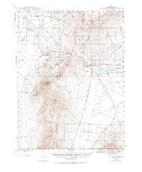
1945 Map of Hot Springs
USGS Topo · Published 1974About this map
The Hot Springs Range and the southern edge of Paradise Valley define this landscape as it was recorded just after World War II. The map highlights a network of ranching operations and early infrastructure along the Little Humboldt River, which notably features both an Old Channel and a New Channel. Rural life is anchored by family-named landmarks like Reinharts Lane and Shelton Lane, which served isolated outposts such as Stocks Farming Company Ranch and Bull Head Ranch.
Find a feature on this map
27 named features on this map. Tap any name to fly to it.
Don’t see what you’re looking for? This feature index may not catch every label — zoom into the map to look around manually.
Map Details
Editions of this 1945 Hot Springs Map
2 editions found
Other maps of this area

1882 · Paradise
USGS Topo · 1:250,000

1893 · Paradise
USGS Topo · 1:250,000

1945 · Osgood Mountains
USGS Topo · 1:62,500

1947 · Osgood Mountains
USGS Topo · 1:62,500

1947 · Hot Springs Peak
USGS Topo · 1:62,500

1955 · McDermitt
USGS Topo · 1:250,000

1958 · Paradise Valley
USGS Topo · 1:62,500

1959 · McDermitt
USGS Topo · 1:250,000

1959 · Bliss
USGS Topo · 1:62,500

1959 · Hinkey Summit
USGS Topo · 1:62,500