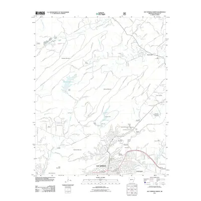
2011 Map of Hot Springs North
USGS Topo · Published 2011About this map
Hot Springs serves as the focal point for this 2011 survey, showing the city's relationship to the surrounding peaks of North Mountain, Hot Springs Mountain, and West Mountain. The map detail reveals an intricate network of local water management, including the Hot Springs Reservoir and a series of dams such as Ricks Dam and Dillon Dam. The landscape is dotted with ancestral landmarks, from family-named burial grounds like Robbins Cemetery and McGill Cemetery to the historic Big Chalybeate Springhouse. This modern record of the area captures the dense residential expansion in Euclid Heights alongside the protected terrain of Hot Springs National Park. Moving northeast, the terrain follows the South-Fork Saline River and Gulpha Creek, where smaller settlements like Ozark Lithia and White Sulphur Springs reflect the region's long-standing connection to its mineral waters and natural springs.
Find a feature on this map
162 named features on this map. Tap any name to fly to it.
Don’t see what you’re looking for? This feature index may not catch every label — zoom into the map to look around manually.
Map Details
Editions of this 2011 Hot Springs North Map
This is the sole edition of this map. No revisions or reprints were ever made.
Other maps of this area

1890 · Benton
USGS Topo · 1:125,000

1890 · Hot Springs
USGS Topo · 1:125,000

1894 · Hot Springs
USGS Topo · 1:125,000

1894 · Benton
USGS Topo · 1:125,000

1948 · Malvern
USGS Topo · 1:62,500

1949 · Malvern
USGS Topo · 1:62,500

1955 · Little Rock
USGS Topo · 1:250,000

1956 · Little Rock
USGS Topo · 1:250,000

1960 · Little Rock
USGS Topo · 1:250,000

1964 · Little Rock
USGS Topo · 1:250,000