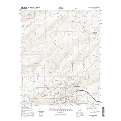
2014 Map of Hot Springs North
USGS Topo · Published 2014About this map
Hot Springs National Park dominates the southern half of this landscape, where the urban reaches of Hot Springs meet the thermal-water terrain of Hot Springs Mountain and North Mountain. The map reveals the intricate network of bathhouse-era infrastructure, including The Gorge and various reservoir features such as Hot Springs Reservoir. Further north, the settlement patterns of Ozark Lithia and Piney are visible amidst the timbered reaches of the Ouachita National Forest. Local history is preserved in several family burial grounds, including Robbins Cem, McGill Cem, and Crabtree Cem. The transition from city streets to the steep slopes of Glazypeau Mountain and Sugarloaf Mountain illustrates the unique geology that defined the development of this celebrated spa town and mountain retreat.
Find a feature on this map
214 named features on this map. Tap any name to fly to it.
Don’t see what you’re looking for? This feature index may not catch every label — zoom into the map to look around manually.
Map Details
Editions of this 2014 Hot Springs North Map
This is the sole edition of this map. No revisions or reprints were ever made.
Other maps of this area

1890 · Benton
USGS Topo · 1:125,000

1890 · Hot Springs
USGS Topo · 1:125,000

1894 · Hot Springs
USGS Topo · 1:125,000

1894 · Benton
USGS Topo · 1:125,000

1948 · Malvern
USGS Topo · 1:62,500

1949 · Malvern
USGS Topo · 1:62,500

1955 · Little Rock
USGS Topo · 1:250,000

1956 · Little Rock
USGS Topo · 1:250,000

1960 · Little Rock
USGS Topo · 1:250,000

1964 · Little Rock
USGS Topo · 1:250,000