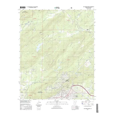
2017 Map of Hot Springs North
USGS Topo · Published 2017About this map
Hot Springs and its surrounding ridge-and-valley landscape are captured here as they appeared in 2017, showcasing the interface between the urban center and the protected wilderness of Hot Springs National Park. The map documents the northern growth of the city toward Euclid Heights and Piney, while emphasizing the steep, forested terrain of North Mountain, Hot Springs Mountain, and Sugarloaf Mountain. Local history and genealogy are anchored by several small burial grounds, including Bain Cemetery and Crabtree Cemetery, which sit near the city's northwestern fringe.
Find a feature on this map
227 named features on this map. Tap any name to fly to it.
Don’t see what you’re looking for? This feature index may not catch every label — zoom into the map to look around manually.
Map Details
Editions of this 2017 Hot Springs North Map
This is the sole edition of this map. No revisions or reprints were ever made.
Other maps of this area

1890 · Benton
USGS Topo · 1:125,000

1890 · Hot Springs
USGS Topo · 1:125,000

1894 · Hot Springs
USGS Topo · 1:125,000

1894 · Benton
USGS Topo · 1:125,000

1948 · Malvern
USGS Topo · 1:62,500

1949 · Malvern
USGS Topo · 1:62,500

1955 · Little Rock
USGS Topo · 1:250,000

1956 · Little Rock
USGS Topo · 1:250,000

1960 · Little Rock
USGS Topo · 1:250,000

1964 · Little Rock
USGS Topo · 1:250,000