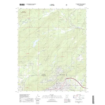
2020 Map of Hot Springs North
USGS Topo · Published 2020About this map
Hot Springs National Park and the surrounding peaks dominate this topographical survey of the Hot Springs region. The town's northern reaches are defined by a complex network of ridgelines including Glazypeau Mtn, Blowout Mtn, and North Mtn, which frame the thermal waters and historic institutional core. The map identifies key local landmarks such as the Garland County Courthouse and National Park College, along with several small family and community burial grounds like Robbins Cem and Crabtree Cem. The transition from the urban grid of Hot Springs to the protected wilderness of the Ouachita National Forest is clearly visible, showing how the local landscape was managed for both resource conservation and public health. To the northeast, the settlement of Ozark Lithia sits near the S Fork Saline River, illustrating the dispersed development patterns beyond the main resort area.
Find a feature on this map
223 named features on this map. Tap any name to fly to it.
Don’t see what you’re looking for? This feature index may not catch every label — zoom into the map to look around manually.
Map Details
Editions of this 2020 Hot Springs North Map
This is the sole edition of this map. No revisions or reprints were ever made.
Other maps of this area

1890 · Benton
USGS Topo · 1:125,000

1890 · Hot Springs
USGS Topo · 1:125,000

1894 · Hot Springs
USGS Topo · 1:125,000

1894 · Benton
USGS Topo · 1:125,000

1948 · Malvern
USGS Topo · 1:62,500

1949 · Malvern
USGS Topo · 1:62,500

1955 · Little Rock
USGS Topo · 1:250,000

1956 · Little Rock
USGS Topo · 1:250,000

1960 · Little Rock
USGS Topo · 1:250,000

1964 · Little Rock
USGS Topo · 1:250,000