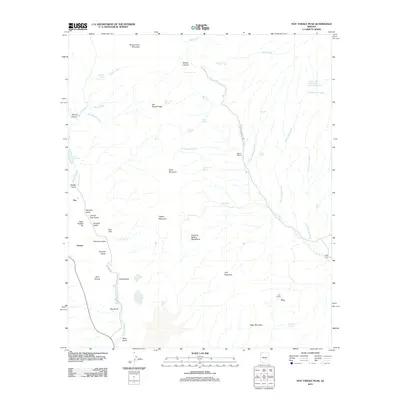
2011 Map of Hot Tamale Peak
USGS Topo · Published 2011About this map
The Dripping Spring Mountains dominate this high-desert landscape in Pinal County, where the industrial mining legacy of the American Southwest meets a rugged ranching tradition. The western edge of the sheet is defined by the massive footprint of the Pearl Handle Pit and the nearby settlements of Ray and Sonora, illustrating the significant scale of resource extraction in the region. To the east, the terrain transitions into a network of drainages and springs where cattle operations like the Slash S Ranch, Hagen Ranch, and Troy Ranch are established.
Find a feature on this map
56 named features on this map. Tap any name to fly to it.
Don’t see what you’re looking for? This feature index may not catch every label — zoom into the map to look around manually.
Map Details
Editions of this 2011 Hot Tamale Peak Map
This is the sole edition of this map. No revisions or reprints were ever made.
Other maps of this area

1900 · Florence
USGS Topo · 1:125,000

1901 · Globe
USGS Topo · 1:62,500

1902 · Globe
USGS Topo · 1:62,500

1902 · Florence
USGS Topo · 1:125,000

1910 · Ray
USGS Topo · 1:62,500

1948 · Pinal Ranch
USGS Topo · 1:24,000

1948 · Superior
USGS Topo · 1:62,500

1948 · Superior
USGS Topo · 1:24,000

1949 · Pinal Ranch
USGS Topo · 1:24,000

1949 · Superior
USGS Topo · 1:24,000