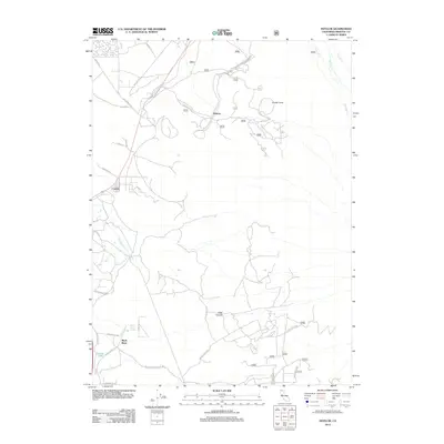
2012 Map of Hotlum
USGS Topo · Published 2012About this map
Hotlum and Carrick sit within a high-elevation landscape defined by volcanic landforms and the complex drainage systems of the Cascade Range. The terrain is dominated by significant elevations such as Black Butte in the southwest and the Cinder Cone to the north, creating a dramatic backdrop for the forest service roads and local arteries that crisscross the area. Water sources are vital to this geography, including Black Butte Spring and Summit Lake, which feed into numerous creeks like Beaughton Cr, Boles Cr, and Whitney Cr. The network of United States Forest Service routes, including Forest Rte 42N15 and Forest Rte 41N89, suggests a region managed for timber and recreation. Local infrastructure such as Quarry Rd and Big Springs Rd connects the small settlements to the broader Siskiyou County transit corridor, reflecting the modern utility of this mountain environment.
Find a feature on this map
45 named features on this map. Tap any name to fly to it.
Don’t see what you’re looking for? This feature index may not catch every label — zoom into the map to look around manually.
Map Details
Editions of this 2012 Hotlum Map
This is the sole edition of this map. No revisions or reprints were ever made.
Other maps of this area

1886 · Shasta
USGS Topo · 1:250,000

1894 · Shasta
USGS Topo · 1:250,000

1922 · Shasta Valley Sheet No 10
USGS Topo · 1:24,000

1922 · Shasta Valley Sheet No 9
USGS Topo · 1:24,000

1934 · Macdoel
USGS Topo · 1:96,000

1935 · Dunsmuir
USGS Topo · 1:125,000

1941 · Macdoel
USGS Topo · 1:125,000

1948 · Weed
USGS Topo · 1:250,000

1950 · Weed
USGS Topo · 1:250,000

1954 · The Whaleback
USGS Topo · 1:62,500