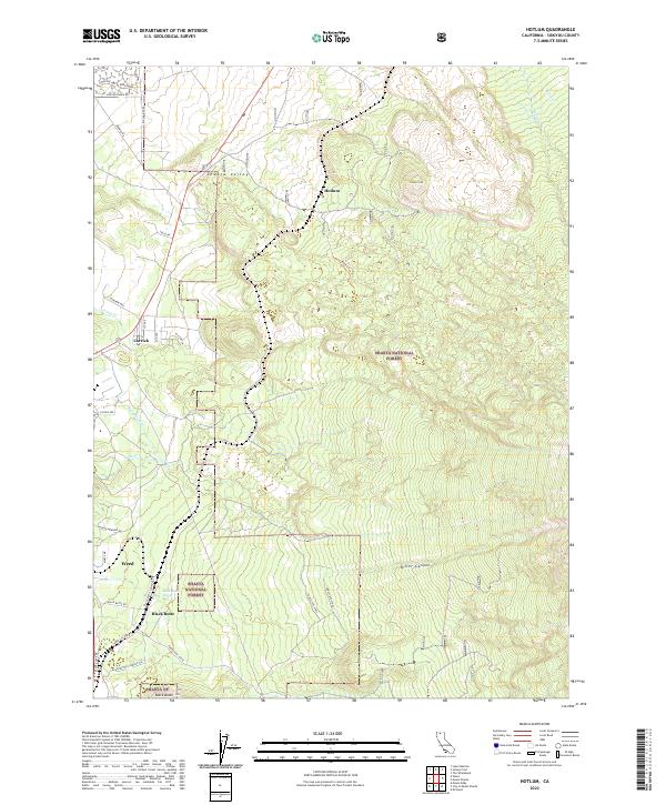
2022 Map of Hotlum
USGS Topo · Published 2022About this map
Shasta Valley dominates the northern landscape of this 2022 survey, giving way to the volcanic terrain of the Shasta National Forest in the south. The settlements of Hotlum, Carrick, and Weed are situated along the lower elevations, where local roads like Big Springs Rd and Jackson Ranch Rd connect rural properties. The geography is defined by prominent volcanic features, most notably the towering Black Butte and the nearby Cinder Cone, reflecting the geological activity of the Cascades. Water sources are abundant but specific to the volcanic environment, including Black Butte Spring and the glacial melt waters of Whitney Cr and Hotlum Cr. High-elevation drainage patterns are visible through Diller Canyon, while the southern reaches are marked by a network of forest routes such as Forest Rte 41N18 that facilitate access through the protected timberlands.
Find a feature on this map
42 named features on this map. Tap any name to fly to it.
Don’t see what you’re looking for? This feature index may not catch every label — zoom into the map to look around manually.
Map Details
Editions of this 2022 Hotlum Map
This is the sole edition of this map. No revisions or reprints were ever made.
Other maps of this area

1886 · Shasta
USGS Topo · 1:250,000

1894 · Shasta
USGS Topo · 1:250,000

1922 · Shasta Valley Sheet No 10
USGS Topo · 1:24,000

1922 · Shasta Valley Sheet No 9
USGS Topo · 1:24,000

1934 · Macdoel
USGS Topo · 1:96,000

1935 · Dunsmuir
USGS Topo · 1:125,000

1941 · Macdoel
USGS Topo · 1:125,000

1948 · Weed
USGS Topo · 1:250,000

1950 · Weed
USGS Topo · 1:250,000

1954 · The Whaleback
USGS Topo · 1:62,500