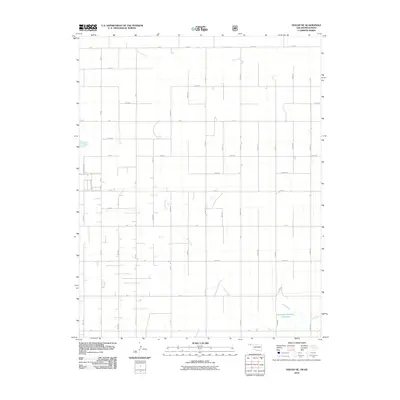
2010 Map of Hough NE
USGS Topo · Published 2010About this map
Pony Creek meanders through this section of Texas County, creating a natural break in the rigid grid of agricultural roads that define the region. The landscape is primarily shaped by large-scale farming and ranching, evidenced by the extensive network of section-line roads like A Blvd and Co Rd 29. One of the most prominent man-made landmarks is the Sturdivan Number 1 Reservoir, which provides a critical water source in this semi-arid part of the Oklahoma Panhandle near the Kansas border. This 2010 survey reflects the modern agricultural infrastructure of the area, where the vast open spaces are partitioned by designated routes such as Road E and Co Rd 23. For those studying the rural development of Oklahoma, the map captures the continuity of land use and the sparse, methodical placement of homesteads and outbuildings characteristic of the High Plains.
Find a feature on this map
36 named features on this map. Tap any name to fly to it.
Don’t see what you’re looking for? This feature index may not catch every label — zoom into the map to look around manually.
Map Details
Editions of this 2010 Hough NE Map
This is the sole edition of this map. No revisions or reprints were ever made.
Other maps of this area

1954 · Perryton
USGS Topo · 1:250,000

1955 · Dodge City
USGS Topo · 1:250,000

1958 · Perryton
USGS Topo · 1:250,000

1958 · Dodge City
USGS Topo · 1:250,000

1959 · Dodge City
USGS Topo · 1:250,000

1967 · Straight
USGS Topo · 1:24,000

1967 · Straight SW
USGS Topo · 1:24,000

1973 · Hough SW
USGS Topo · 1:24,000

1973 · Hough NE
USGS Topo · 1:24,000

1973 · Hough NW
USGS Topo · 1:24,000