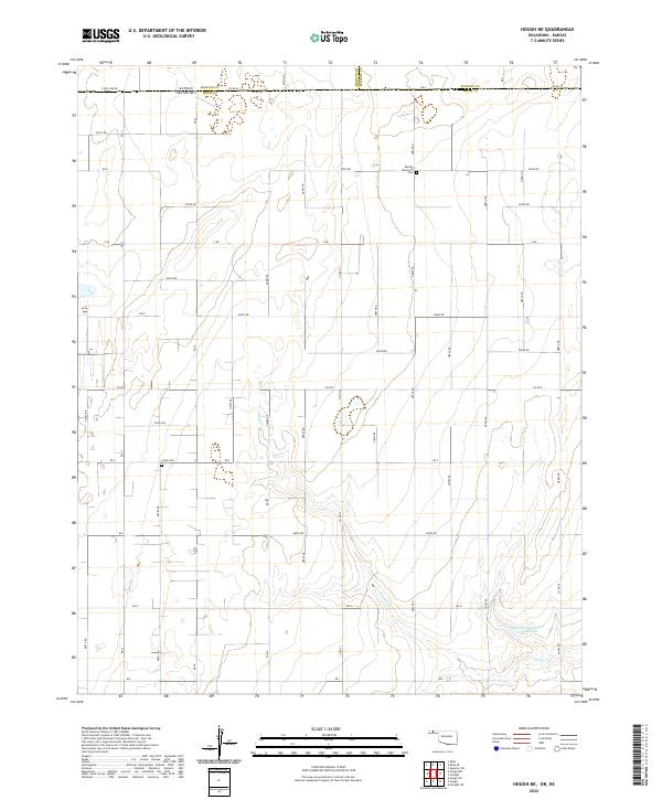
2022 Map of Hough NE
USGS Topo · Published 2022About this map
The high plains borderland between Oklahoma and Kansas is defined here by a geometric grid of rural roads and scattered water resources. The boundary separating Kansas Morton Co and Oklahoma Texas Co runs across the northern portion of the map, while the tri-county junction of Morton, Stevens, and Texas counties is clearly marked. This area is characterized by dryland farming and ranching, where local topography is punctuated by features like Pony Cr and the Sturdivan Number 1 Reservoir. Genealogists will find interest in the isolated burial sites that serve this sparsely populated region, including Barden Memorial Cem and Camp Cem, which remain as permanent landmarks in an otherwise open, agricultural landscape. The road network, including routes like E0020 Rd and Co RD 27, provides the primary structure for the region's rural life and transit.
Find a feature on this map
47 named features on this map. Tap any name to fly to it.
Don’t see what you’re looking for? This feature index may not catch every label — zoom into the map to look around manually.
Map Details
Editions of this 2022 Hough NE Map
This is the sole edition of this map. No revisions or reprints were ever made.
Other maps of this area

1954 · Perryton
USGS Topo · 1:250,000

1955 · Dodge City
USGS Topo · 1:250,000

1958 · Perryton
USGS Topo · 1:250,000

1958 · Dodge City
USGS Topo · 1:250,000

1959 · Dodge City
USGS Topo · 1:250,000

1967 · Straight
USGS Topo · 1:24,000

1967 · Straight SW
USGS Topo · 1:24,000

1973 · Hough SW
USGS Topo · 1:24,000

1973 · Hough NE
USGS Topo · 1:24,000

1973 · Hough NW
USGS Topo · 1:24,000