
1973 Map of Hough NW
USGS Topo · Published 1975About this map
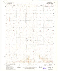
The Carthage Oil and Gas Field dominates this 1970s landscape along the border of Oklahoma and Kansas, where a dense network of energy infrastructure defines the high plains. The map reveals the extensive industrial footprint of the era, with dozens of active Gas Wells and a prominent Pipeline cutting across the terrain. While the modern economy is driven by subterranean wealth, traces of earlier transport remain visible in the Old Railroad Grade found in the southern reaches of the quadrangle.
Find a feature on this map
11 named features on this map. Tap any name to fly to it.
Don’t see what you’re looking for? This feature index may not catch every label — zoom into the map to look around manually.
Map Details
Editions of this 1973 Hough NW Map
This is the sole edition of this map. No revisions or reprints were ever made.
Other maps of this area

1954 · Perryton
USGS Topo · 1:250,000

1955 · Dodge City
USGS Topo · 1:250,000

1958 · Perryton
USGS Topo · 1:250,000

1958 · Dodge City
USGS Topo · 1:250,000

1959 · Dodge City
USGS Topo · 1:250,000

1973 · Eva SE
USGS Topo · 1:24,000

1973 · Hough SW
USGS Topo · 1:24,000

1973 · Hough NE
USGS Topo · 1:24,000
1973 · Eva NE
USGS Topo · 1:24,000
1973 · Hough
USGS Topo · 1:24,000