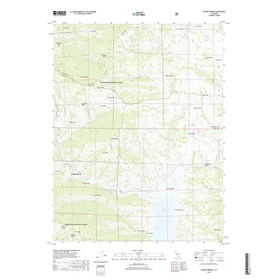
2018 Map of Hough Springs
USGS Topo · Published 2018About this map
Hough Springs serves as a primary reference point in this landscape where the high ridges of the Mendocino National Forest meet the southern water systems of Lake County. The terrain is defined by a series of prominent glades and ridges, including Wyley Glade, East Glade, and Soapstone Ridge, which separate the various forks of Spanish Creek and Mill Creek. The southern portion of the map is dominated by the Indian Valley Reservoir, where Kilpepper Creek and North Fork Cache Creek converge. This area shows a complex network of seasonal water sources such as Complexion Spring and Dead Shot Spring, illustrating the importance of reliable water in these mountain canyons. Historic movement through the area is traced by the Colusa Co Road (Goat Mtn) and the Pacific Ridge road, connecting remote points like Davis Flat to the larger valley systems.
Find a feature on this map
65 named features on this map. Tap any name to fly to it.
Don’t see what you’re looking for? This feature index may not catch every label — zoom into the map to look around manually.
Map Details
Editions of this 2018 Hough Springs Map
This is the sole edition of this map. No revisions or reprints were ever made.
Other maps of this area

1920 · Venado
USGS Topo · 1:62,500

1924 · Bartlett Springs
USGS Topo · 1:62,500

1942 · Bartlett Springs
USGS Topo · 1:62,500

1943 · Lodoga
USGS Topo · 1:62,500

1944 · Bartlett Springs
USGS Topo · 1:62,500

1944 · Wilbur Springs
USGS Topo · 1:62,500

1951 · Stonyford
USGS Topo · 1:62,500

1957 · Ukiah
USGS Topo · 1:250,000

1958 · Clearlake Oaks
USGS Topo · 1:24,000

1960 · Ukiah
USGS Topo · 1:250,000