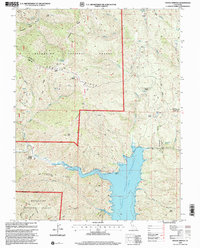
1996 Map of Hough Springs
USGS Topo · Published 2001About this map
Hough Springs and its associated water tank sit near the junction of mountain roads and the North Fork Cache Creek, serving as a focal point for this section of the Mendocino National Forest. The landscape is defined by the massive Indian Valley Reservoir, which occupies the eastern valley floor, significantly altering the drainage patterns of Stanton Creek and Mill Creek. Numerous natural springs, such as Tule Glade Spring and Complexion Spring, are scattered across the high ridges, indicating a geography where water access was critical for early forest management and seasonal settlement.
Find a feature on this map
44 named features on this map. Tap any name to fly to it.
Don’t see what you’re looking for? This feature index may not catch every label — zoom into the map to look around manually.
Map Details
Editions of this 1996 Hough Springs Map
This is the sole edition of this map. No revisions or reprints were ever made.
Other maps of this area

1920 · Venado
USGS Topo · 1:62,500

1924 · Bartlett Springs
USGS Topo · 1:62,500

1942 · Bartlett Springs
USGS Topo · 1:62,500

1943 · Lodoga
USGS Topo · 1:62,500

1944 · Bartlett Springs
USGS Topo · 1:62,500

1944 · Wilbur Springs
USGS Topo · 1:62,500

1951 · Stonyford
USGS Topo · 1:62,500

1957 · Ukiah
USGS Topo · 1:250,000

1958 · Clearlake Oaks
USGS Topo · 1:24,000

1960 · Ukiah
USGS Topo · 1:250,000